Common Market


ITINERARY: 28TH FEBRUARY - 3RD MARCH, 2025

The EAPCE’25 Pre-Conference field excursion is a 4-day trip from 28th February to 3rd March, 2025. The trip will provide an opportunity to cruise along the Uluguru mountain chains and understand the structural and stratigraphic framework of the northern part of the Selous failed rift basin. Along the way, delegates will make few stops to appreciate the well-exposed sections of Permo-Triassic (Karoo) and Jurassic sediments that mark the main targets for hydrocarbon generation in the Ruvu Basin and will also visit a viewpoint to enjoy the magnificent scene of the Kilosa Kilombero basin that constitutes potential elements for the oil and Gas generation and accumulation.

The delegates will also see the attractiveness of the Nyerere National Park the largest National Park in Africa (formerly Selous Game Reserve), including its diverse wildlife, birds, grasslands and tree species located in the basin and be able to visit the Julius Nyerere Hydroelectric Power plant.
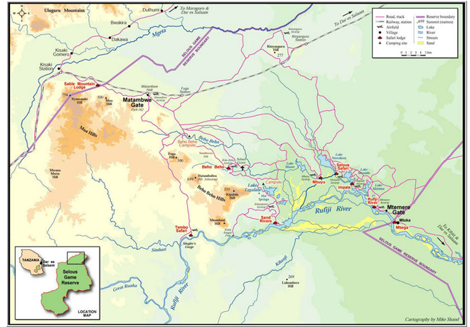
A map showing part of the Nyerere National Park area and routes to be followed (Cartography by Mike Shand)


DAY 1: 28TH FEBRUARY 2025 - DAR ES SALAAM TO KILOSA SUB BASIN VIA MOROGORO


The trip from Dar es Salaam to Kilosa via Morogoro Town, will take you through Neogene sediments in Dar es Salaam and magnificent exposure of Jurassic sediments at Msolwa quarry and a good look of the Jurassic Sediments-Basement rocks contact at Msolwa bridge area.
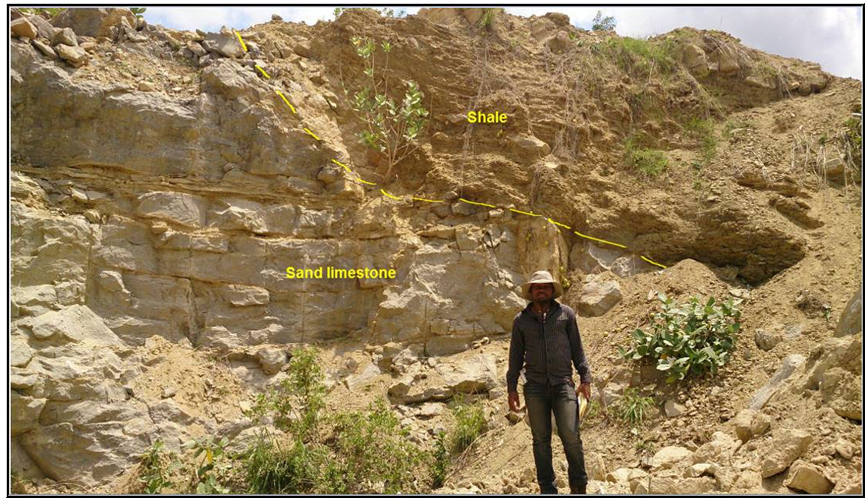
Msolwa quarry with good exposer of sand limestone overlain by Shale


Thereafter, delegates will have the opportunity to appreciate the gorgeous scenery of the Uluguru mountain chains of the Mozambique Orogenic Belt when driving to Morogoro town.

Further, at Kilengezi village the delegates will observe good exposure of Permian to Triassic tillites which indicates the occurrence of glacial period during that time.

Along the road to Kilosa town, delegates will observe the beautiful scenery of the Sagara Mountains and briefly learn the geological features that characterize the basin. The Sagara Mountains form the western boundary of the Kilosa Rift, that formed by large-scale block faulting and tilting.

At Ilonga village view point near Kilosa Town, the delegates will be able to view the beautifulness of the lowland and wetland of the Kilosa sub basin which is part of the Kilosa Kilombero Basin potential for hydrocarbon exploration. The flat alluvial marshland of the Kilosa Valley is the down thrown block of the rifting.

Later, the delegates will drive back to Morogoro town for a night stay at the foot of the Uluguru Mountain at Nashera Hotel.


DAY 2: 1st MARCH, 2025 - MOROGORO TO SELOUS BASIN VIA KISAKI TOWN

Along the way Delegates will make a Stop at Kivuma village in Mkuyuni ward, the delegates will observe good-quality white marble at Guandui mine.

Delegates will stop at Chamanyani Hill (Msonge Village) to view the First glimpse of the Selous basin as approaching from the North. Down to the basin, the delegates will observe the synrift Karoo sediments overlying the Basement.
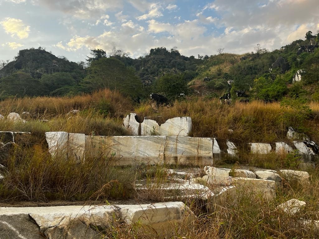
The outcrops seen: Metamorphosed dolomitic marbles observed in abandoned mine at Changa Village. The marbles are extensively distributed and well exposed in this area.


Further down to the Basin at Kilengezi village, the delegates will observe the Permian to Triassic tillites which is an indication of the glacial event during that time and mark of the syn-rift deposits
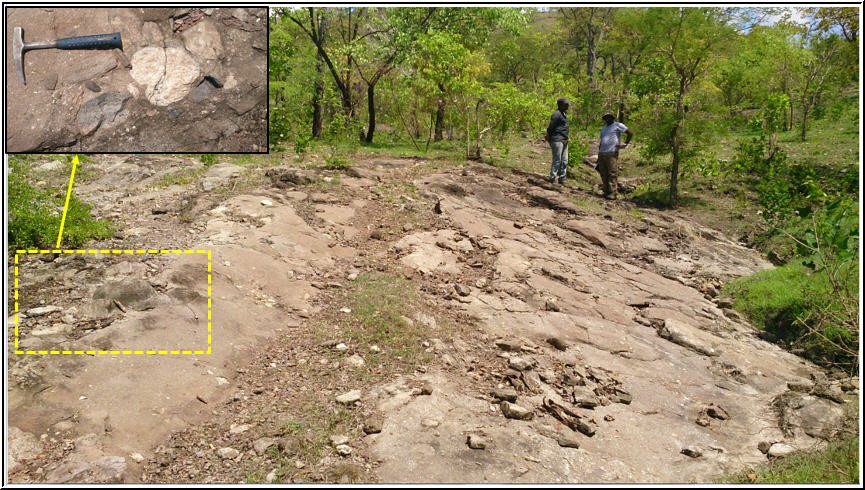
Tillites exposed at Kilengezi village consisting of unsorted large boulders of basement (marble, gneiss and quartzite), sub rounded to rounded pebbles and cobbles deposited by melting glacial and then transported and deposited by river formed after melting of ice.


Then delegates will have lunch at Kilegezi tilites exposure for 30 minutes and then drive to Sable Mountain Lodge at Kisaki for the night stay.
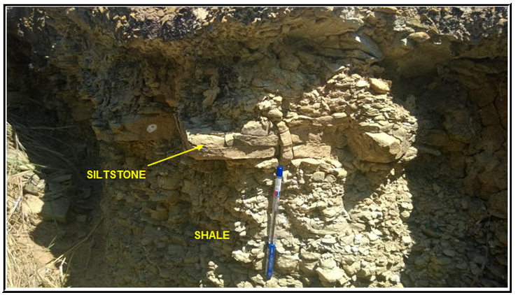
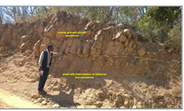
Karoo outcrops, Olive greenish grey shale exposed at Fuga hill and Kidahi area


Karoo outcrops, Olive greenish grey shale exposed at Fuga hill and Kidahi area


DAY 3: 2ND MARCH, 2025: SABLE MOUNTAIN LODGE TO MARAMBWE GATE AND TAGALALA HOTSPRING

The delegates will drive from Sable Mountain Lodge to Julius Nyerere Hydropower Project (JNHPP) via the Matambwe gate to spend two hours of memorable visit of the dam, which is under construction. Once completed the dam will be the fourth largest dam in Africa, the ninth largest in the world, and the largest power station in East Africa.
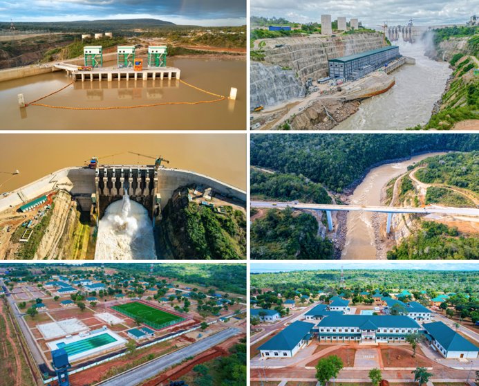
 

The Overview of Julius Nyerere Hydropower Project


The delegates will then drive to Tagalala Lake to observe its magnificent view and the diverse wildlife and bird species around and within the lake. Then, they will drive to Tagalala Hot Springs to observe a pool of hot water and bitumen embedded within the sandstone breccia, which is a good indication of the existence of a petroleum system.
 

A photography showing (A) Lake Tagalala (B) A pool of Tagalala hotspring (C) The sandstone breccias embedded with bitumen (D) A carbonate precipitate on the sandstone outcrop.


Then, delegates will have a one-hour lunch break at the Tagalala public picnic site.

On the way back to Sable Lodge, the delegates will spend a few minutes at the Behobeho area to see the grave of a British Hunter, Frederick Selous, and get his short history. Thereafter, observe the continental muddy limestone concretion in Behobeho area.  
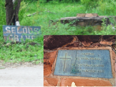
 

The grave of Selous, a British hunter, explorer, naturalist and conservationist, whose name was given to a hunting reserve –Selous Game Reserve (Now Nyerere National Park).
 
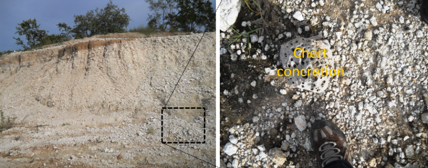
Muddy limestone with limestone concretion body at Behobeho.

During the drive back to Sable Mountain Lodge, the delegates will further observe the natural beauty of Nyerere National Park by its wildlife varieties around the park and in Lake.
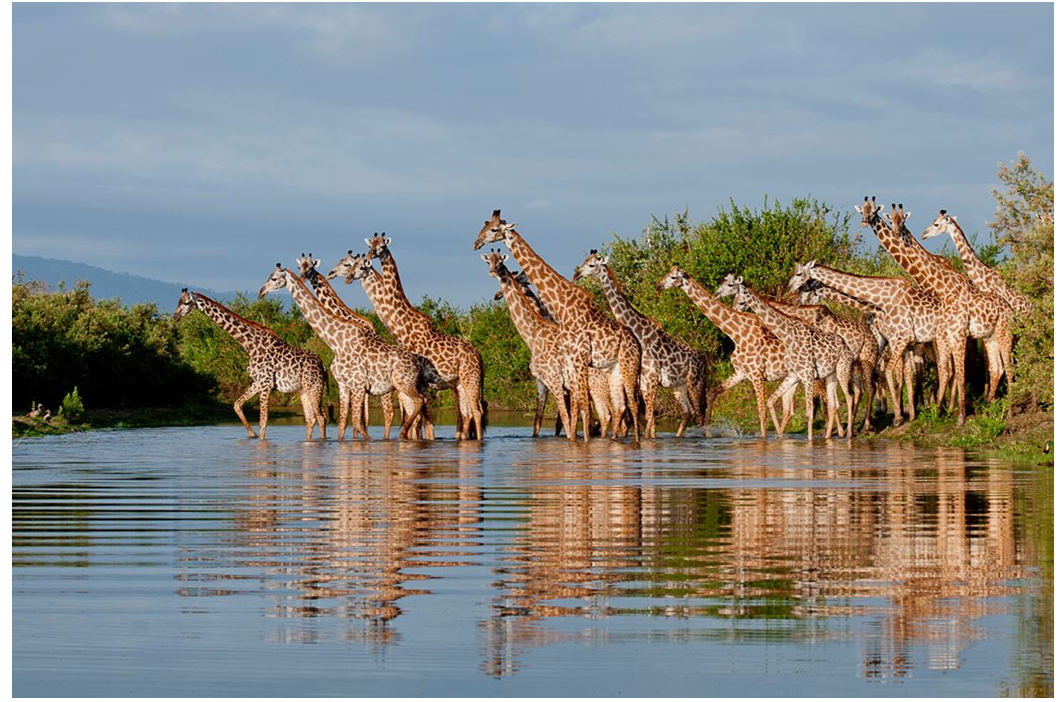
Giraffes at Nyerere National Park (the Selous)


DAY 4: 3RD MARCH, 2025: SABLE MOUNTAIN LODGE TO LAKE SIWANDU AND DRIE BACK TO DAR ES SALAAM VIA MTEMERE GATE

The delegates will drive from the Lodge into Nyerere National Park via Matambwe gate for the wildlife tour. In the park, they will stop at Kinyangulu to see the buffalo and then go to lakes Siwandu, Mzizima 1, and 2 to see a variety of beautiful wildlife species around the lakes.

The delegates will again stop at River View, where they will see Hippos and Crocodiles in the Rufiji River. They will then proceed to the Mtemere area, where they will have a 30-minute Lunch break while observing various wildlife species.
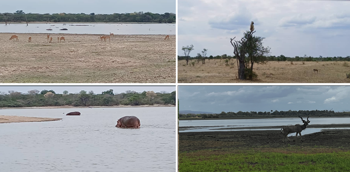
 

A sable found at Lake Siwandu, one among the eight (8) Ox-bow lakes of Rufiji River within the national park.


Finally, the delegates will drive back to Dar es Salaam via Mtemere gate to participate in the conference the following days.


Fees:

US$ 1,150 per person non – residents

US$ 960 per person for East African residents

Includes meals, transport, accommodation and park entry fees.


Contact:

Ms. Neema Maganza,
Petroleum Geologist Tanzania Petroleum
Development Corporation (TPDC),
P. O. Box 2774, Dar es Salaam.
Email: This email address is being protected from spambots. You need JavaScript enabled to view it.
Cell phone: +255 754 896 161


ITINERARY: 1ST - 3RD MARCH, 2025

DAY 1: ARRIVAL IN KIGALI

Upon arrival at Kigali International Airport, delegates will be welcomed and transferred to their designated hotel in Kigali for an overnight stay, allowing time for rest before the excursion begins.

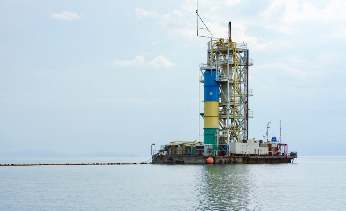
Methane Gas extraction Plant


DAY 2: KIGALI TO AKAGERA NATIONAL PARK

In the morning, delegates will be picked up from the hotel and begin their journey to Akagera National Park, located 106 km east of Kigali. Midway through the trip, there will be a stop at the Imigongo Art Center, where delegates can stretch their legs, enjoy a refreshing cup of coffee, and admire the traditional Imigongo art. Souvenir collection is available at the center.

Upon arrival at Akagera National Park, delegates will embark on an exciting exploration of the park’s diverse wildlife. Activities will include birdwatching, nature walks, and a nocturnal game drive. Additional activities include a boat ride and fishing on Lake Shakani, all guided by a trained Akagera National Park ranger.

A scenic stop at Lake Ihema will allow delegates to enjoy a packed picnic lunch while taking in the breathtaking views. Afterward, they will return to Kigali for an overnight rest to prepare for the next day’s journey.


DAY 3:  KIGALI TO RUBAVU AND MUSANZE


The excursion will continue from Kigali to Rubavu, a town located 148km northwest along the shores of Lake Kivu. Delegates will visit the methane gas extraction platform on Lake Kivu. Where they will be introduced to the innovative technology used to extract methane gas dissolved in the lake, the process, including the separation of methane gas and water, how it’s treated to generate electricity, will be thoroughly explained. Midway through the trip to Rubavu, the delegates will stop for a coffee break to refresh before proceeding.

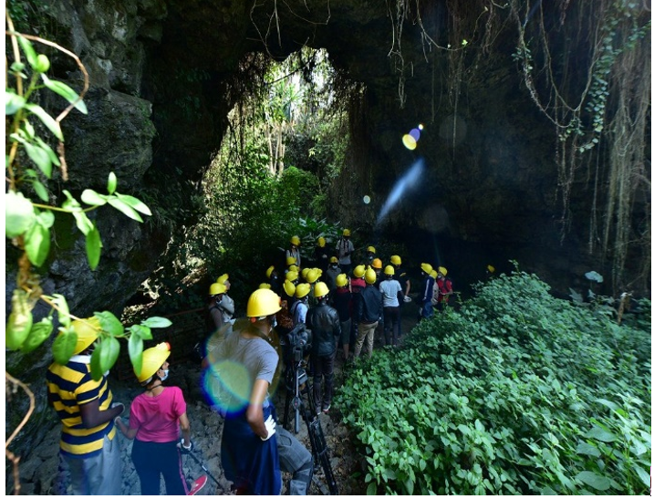
After the visit to the methane extraction site, the group will continue to Musanze for lunch at Classic Hotel. Following lunch, delegates will explore the Musanze Caves, formed as a result of volcanic activity in the Virunga Volcanic Region, offering an impressive geological experience.

Musanze caves
Musanze caves


On the return journey to Kigali, a stop at the Nyirangarama Factory will provide an opportunity for delegates to purchase the famous Akabanga chili sauce as a unique Rwandan souvenir.


Fees: US$900 per person.

Cost will cover local transport, meals and access to excursion venues

Contact information

Gaspard Nyandwi
Petroleum Engineer
Rwanda Mines, Petroleum and Gas Board
E-mail: This email address is being protected from spambots. You need JavaScript enabled to view it.
Cell-phone: +250781715183


ITINERARY: 1ST - 3RD MARCH, 2025

DAY 1:

Delegates will depart f rom Nairobi, making a first stop (Stop 1) at the Big Five View Point, to observe the step faulting of the eastern branch of the Great East African Rift Valley. From here delegates will also have a beautiful distant view of Mount Longonot on the rift floor to the northwest, and Mount Suswa to the south.


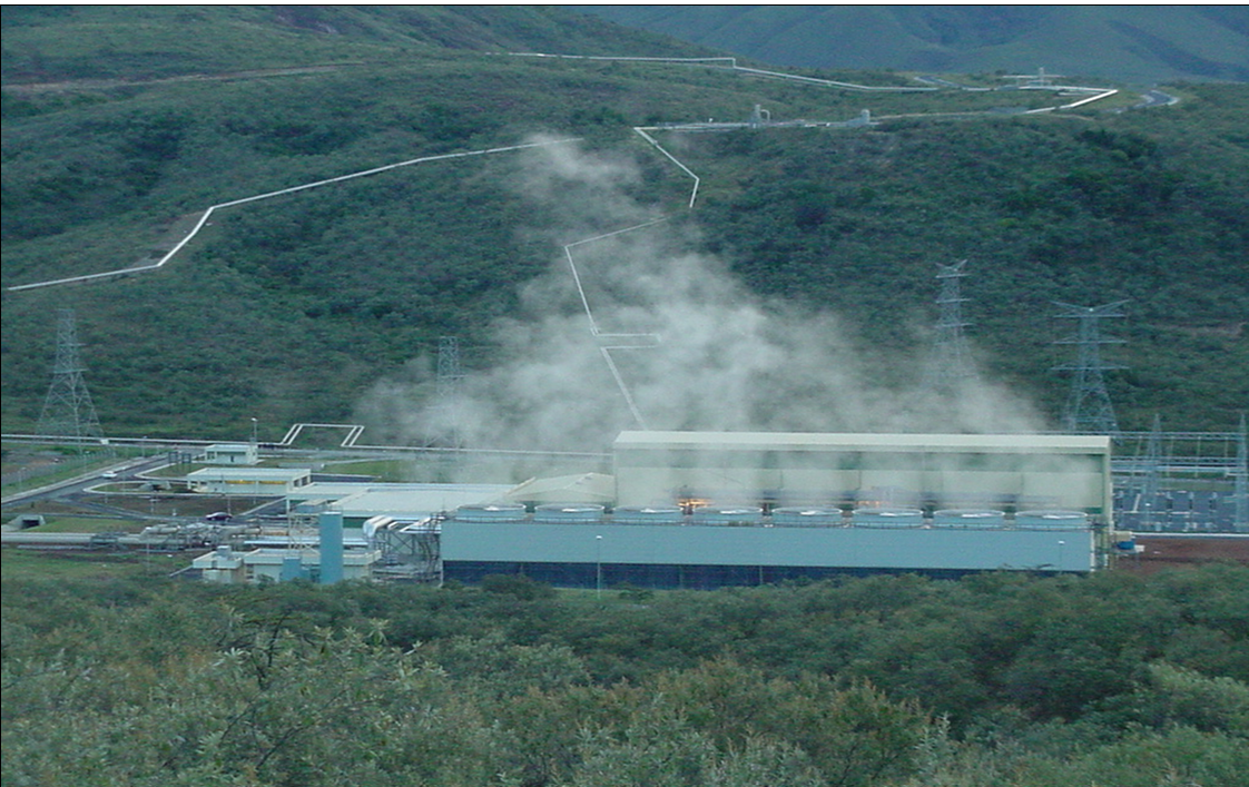
The next stop (Stop 2) will be at the Flyover View Point where delegates will have a closer view of Mount Longonot caldera that stands at 2500m above sea level. Delegates will then be driven all the way to Olkaria via Naivasha Town, through the numerous flower farms along Lake Naivasha shores to Olkaria I & II Geothermal Development Complexes (Stop 3).


Geothermal Development Complex


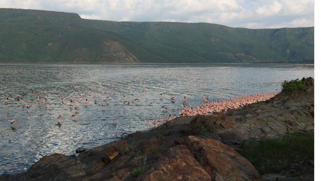
Delegates will then be driven to Nakuru Town for lunch. Thereafter, drive for about 100km north to Lake Bogoria SPA Resort where they will be staying during the field trip. The Hotel is renowned for being the only one in Kenya with a naturally heated spa pool, associated with hot springs and its therapeutic values.


Lake Bogoria


DAY 2:

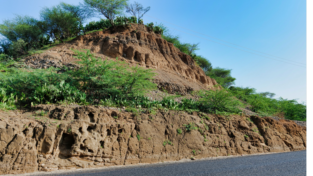
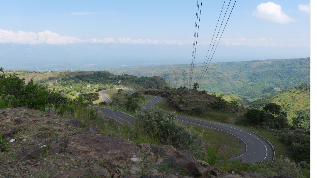
Delegates will drive west wards towards Kabarnet stopping at the Kapthurin formation (Stop 4) near Marigat town to observe the fluvial deposits. Delegates will then be driven to Kerio Valley along the scenic zig-zag road, through a thick tropical forested Kabarnet Hills via Karbarnet town before stopping at the edge of the Eastern Escarpment (Stop 5) of the Kerio Valley at Eastern View Point to observe the Elgeyo Escarpment with beautiful meandering Kabarnet-Iten road.


Kapthurin formation


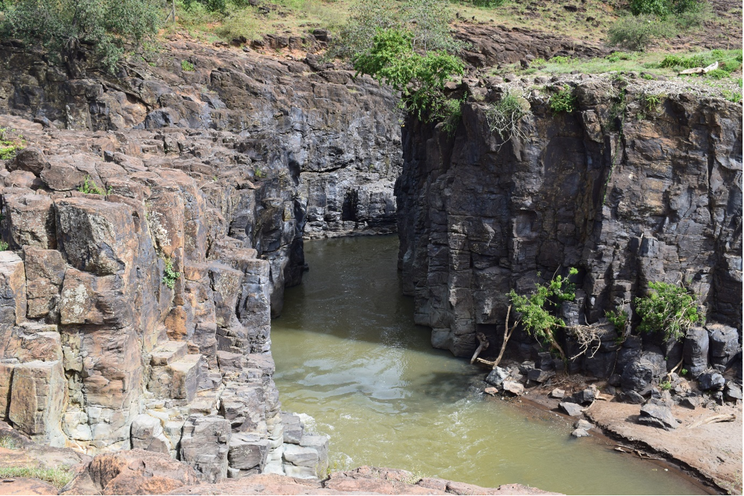
Delegates will start descending along a meandering road and stop at the Cheploch Bridge (Stop 6) where a thick exposure of about 40m of Kabarnet trachyte can be observed in a deep canyon that has been dissected by the Kerio River.
 

Kerio Valley along the scenic zig-zag road


Delegates will start descending along a meandering road and stop at the Cheploch Bridge (Stop 6) where a thick exposure of about 40m of Kabarnet trachyte can be observed in a deep canyon that has been dissected by the Kerio River.


Section of the Kabarnet Trachyte at the Kerio River Bridge


At the Kolol View Point (Stop 7). Basement rocks of the K-feldspar-rich pegmatite rocks are exposed with numerous slicken slides.

Delegates will view the Miocene Tambach Formation (Stop 8) which is the potential reservoir and source rocks in the region. More than 20m thickness of the section is exposed consisting of inter bedded shales and sandstones. Delegates will be driven northwards along the valley to the top of the Elgeyo Escarpment at the Iten View Point. After lunch delegates will be driven back to Lake Bogoria SPA Resort.


Basement Rocks at Kolol View Point


DAY 3:

Delegates will check out of Lake Bogoria Spa Hotel and visit the Lake Bogoria Reserve to view the hot springs and wildlife and thereafter drive back to Nairobi.

Fees: US$ 1,200 per person:

Costs include transport, accommodation, meals, and park fees. Delegates should also ensure that they come with the appropriate field gear e.g., field boots.


Contact Details:

Gilbert Kipruto
Senior Geologist
State Department for Petroleum
6th Floor, KASNEB Towers II,
Upperhill Nairobi, Kenya.
Email. This email address is being protected from spambots. You need JavaScript enabled to view it.
Cell Phone: +254 701 528682


ITINERARY: 1ST - 3RD MARCH, 2025

A three (3) days pre-conference field excursion to the central and northern part of the Albertine graben is planned to provide an opportunity to the delegates to observe the geology of these areas, discoveries, developments in the Industrial Park including the International Airport and field developments and tour the famous Murchison Falls National Park.


DAY 1:  KABALENGA INDUSTRIAL PARK, KAISO-TONA GEOLOGY AND KINGFISHER DEVELOPMENT PROJECT

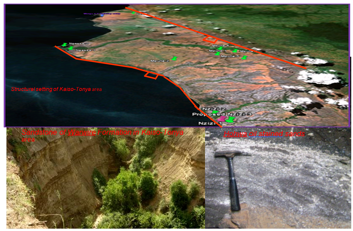
Delegates will leave Entebbe for Hoima City located in the Central part of the Albertine Graben. The first day will be spent in the Kaiso-Tonya area. Kaiso-Tonya lies in a faulted large-scale relay ramp (synthetic transfer zone) formed by overlapping synthetic boundary faults controlling the southern and northern Lake Albert depocenters. The area at the same time is an accommodation zone. Between these two major faults lies other three sets of faults that have accommodated the associated stresses trending E-W, NE-SW and in the N-S directions. Kaiso-Tonya geology has been divided into four Formations namely; Nkondo, Warwire, Sebugoro and Kaiso.


Stop 1: will be made at Kabaale Industrial Park to discuss the refinery and basin wide developments of the discovered resources in Albertine graben, and the progress of the Kabalega International Airport

Stop 2 & 3: will be made in the Nzizi and Mputa fields in Kaiso-Tonya. Mputa discovery is important to the Albertine Graben and the EARS as it was the first commercial oil discovery in East Africa.

Stops 4: Kingfisher Development Project and support Infrastructure development to understand the progress and journey to First Oil.
The delegates will head to Hoima City and spend the night.

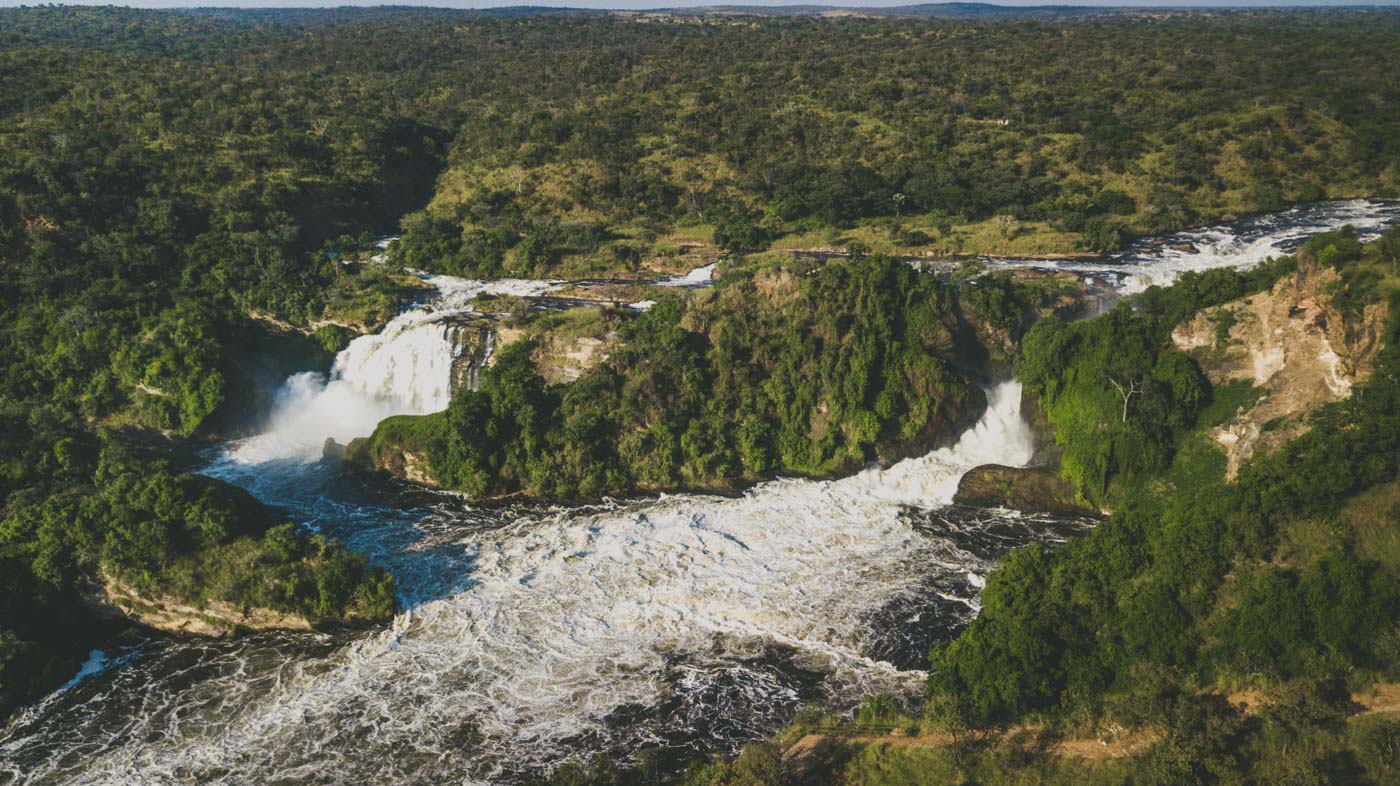
Murchison Falls
Murchison Falls


DAY 2: BULIISA-WANSEKO GEOLOGY AND DISCOVERIES

Stops 1–2 Petroleum exploration operations in Butiaba-Wanseko area

Stop 1: The team will drive from Hoima City and make a stopover at the top of the escarpment to study the geometry of Northern Lake Albert basin, view the Waki dome and its associated rift margin prospects.

Stop 2: A stop at one of the well pads in Gunya Field and the Industrial Area within the Tilenga Project to understand the progress towards the First oil.

Stop 3: Boat ride on the Victoria Nile

Kaiso-Tonya structural setting and geology


The delegates will head to Hoima town and spend the night.

Participants will take a boat ride in the late afternoon on the Victoria Nile to see the Paraa seep and the bottom of Murchison falls. From the boat, reservoir quality sandstone exposures will be seen along the riverbanks and the Paraa oil seep on the surface of Victoria Nile.

From geochemical studies, the Paraa oil seep is a Type-1, mid-mature, lacustrine source. The manifestation of hydrocarbons on the surface (on Victoria Nile) confirms the presence of a mature source rock, which has generated and expelled oil.

Stop 4: Boat ride on the Victoria Nile
Participants will take a boat ride in the late afternoon on the Victoria Nile to see the Paraa seep and the bottom of Murchison falls. From the boat, reservoir quality sandstone exposures will be seen along the riverbanks and the Paraa oil seep on the surface of Victoria Nile.


Nyamsika sandstone exposure on the banks of the Victoria Nile (l) and Oil film on the Victoria Nile (r)


DAY 3: GAME DRIVE IN MURCHISON PARK & RETURN TO ENTEBBE

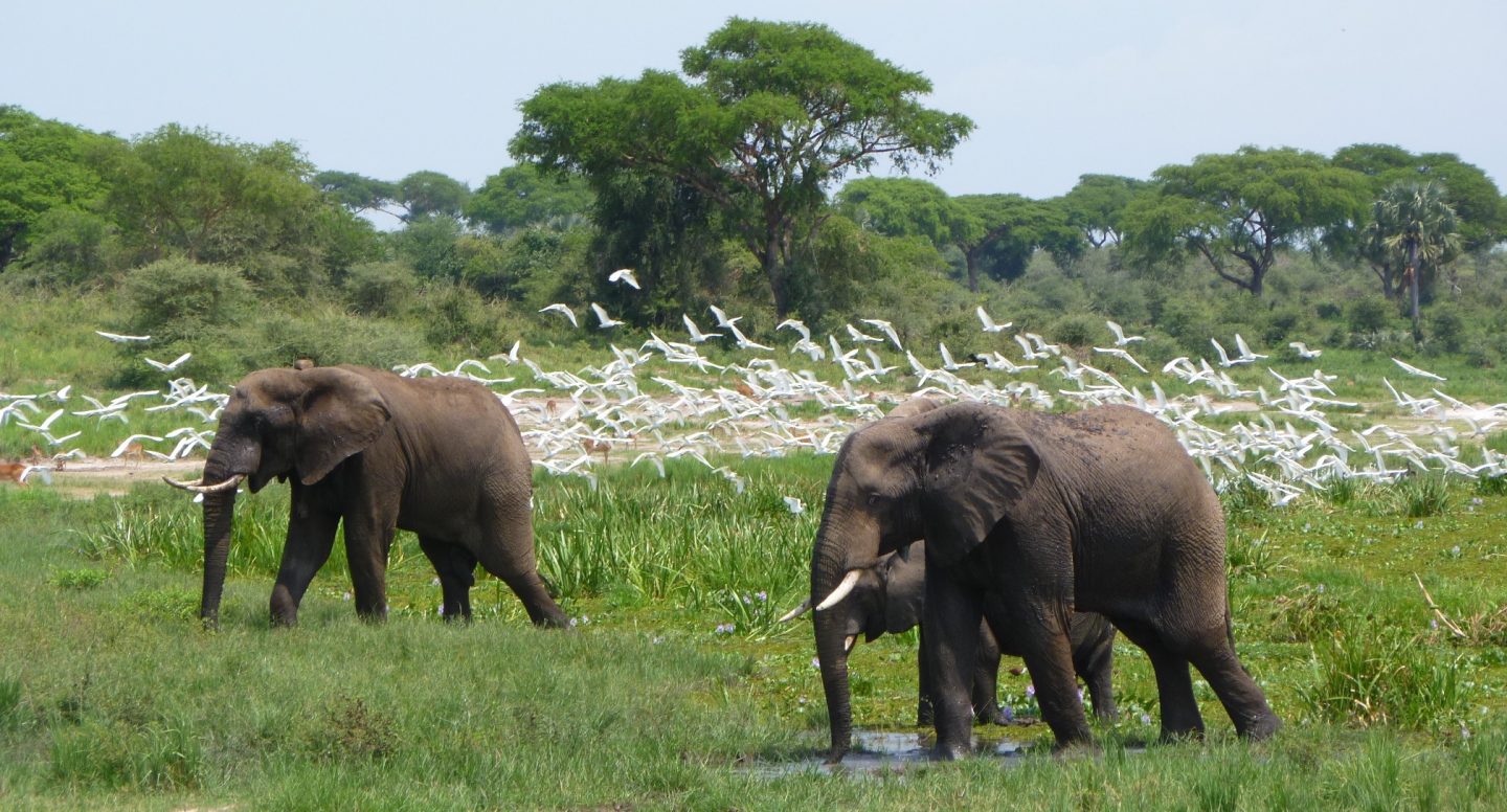
Participants will have a game drive through the Murchison Falls National Park early in the morning before returning to Entebbe via Masindi, in preparation for the conference in Kampala, Uganda.

Some of the attractions of the Murchison Falls National Park


Fees: US$900 per person.

Costs include transport, accommodation, meals and park fees. Delegates should ensure they carry appropriate field gear e.g. field boots.

Contact:

Tonny Sserubiri
Principal Geologist/Exploration
Petroleum Exploration, Development and Production Department
21-29 Johnstone Road. P.O. Box 9, Entebbe/Uganda
Office: +256 414 320714
Fax:     +256 414 320437
Mobile:   +256 781163590/703463009
Email:  This email address is being protected from spambots. You need JavaScript enabled to view it.

© Copyright 2024 East African Community
25th Anniversary of the East African Community (1999 - 2024).
All Rights Reserved.

Search